1. Prevention · Strategic spatial planning
Pluvial flood modelling · Madagascar
Shows planners where heavy rain floods the land directly, before any river overflows, so they can keep new development out of the worst spots and put drainage where it helps most.
The problem
Intense rain floods streets, fields and low-lying plains directly, often before any river overflows, and in Madagascar cyclones bring the most extreme rain. Planners need to know where that water collects, how deep it gets and how often.
Approach
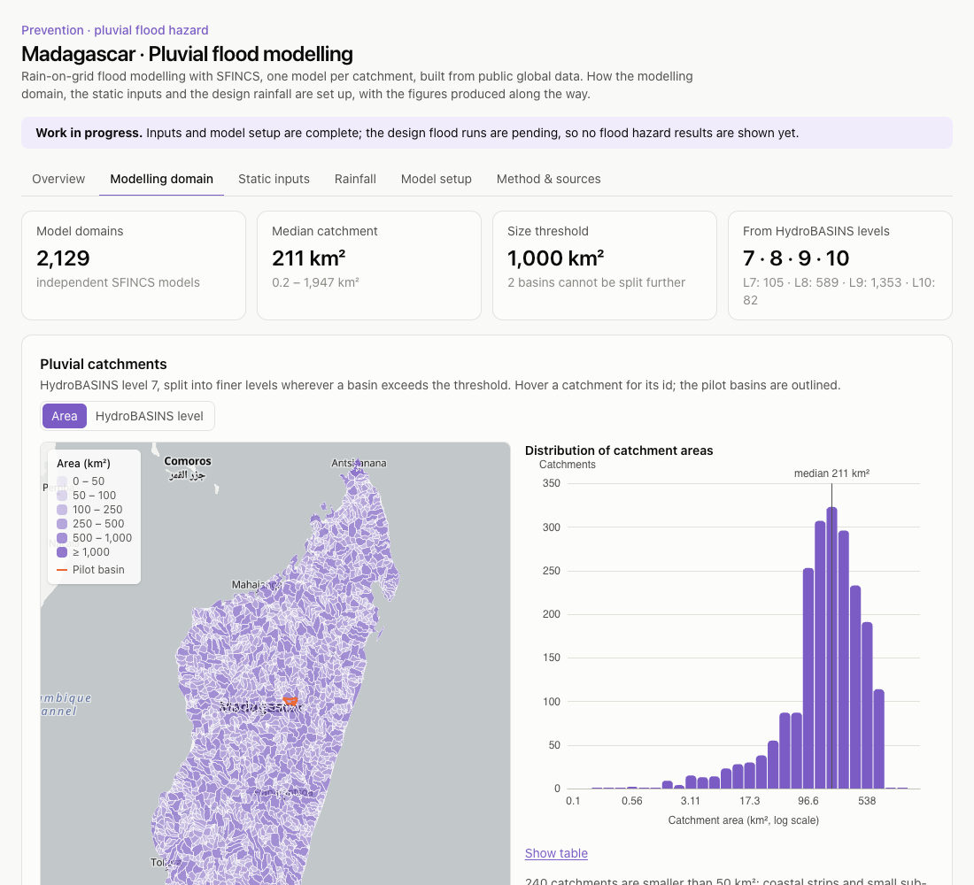
- The island is split into 2,129 catchments, each an independent SFINCS rain-on-grid model, so the work can focus on agricultural or urban areas and run in parallel. They are HydroBASINS level 7 basins, split into finer nested levels wherever a basin exceeds 1,000 km².
- Every input is downloaded on the fly for each catchment from public global data: FABDEM terrain, Copernicus land cover for roughness, GCN250 curve numbers for infiltration.
- The GPM rainfall record (1998–2024) is split into tropical-cyclone, non-cyclone and total rain using IBTrACS best tracks. Design storms are fitted per population, with the total derived from the two so that it is never below either.
- Maximum water levels are projected onto the 25 m terrain to map flood depth for each return period.
Status
Domain, inputs, rainfall segmentation and model setup are published with their figures. The chain has been tested end to end on two pilot catchments; the design flood maps follow once the sub-daily rainfall profile is calibrated.
- Tools
- SFINCS · HydroMT-SFINCS · Python / xarray · rasterio · React · MapLibre · ECharts
- Open data
- FABDEM · Copernicus Global Land Cover · GCN250 · SoilGrids · HydroBASINS · GPM IMERG · IBTrACS